What are bioregions?
Writer Peter Berg and ecologist Raymond Dasmann, both affiliated with the San Francisco environmental organization Planet Drum Foundation, popularized the term "bioregion" in the 1970s.
Every place on the Earth’s surface lies within a bioregion. One way to define the term is to say that a bioregion is a watershed area– the drainage basin of a stream or river. But this is not the only possible definition of "bioregion."
More generally, a bioregion is a place that has commonalities of soil, surface water source, landforms, wildlife, climate and culture. The bioregionalism movement, which is still active today, calls for defining areas based not on ecologically meaningless political boundaries but instead on natural geographic boundaries and characteristics. The border between California and Oregon, for example, is a straight line that cuts straight across watersheds. A bioregional boundary would meander, tracing the dividing line between watersheds.
To live bioregionally is to live aware of the local ecology, steeped in the natural and indigenous history of the place and committed to making choices that help to balance human impacts with the carrying capacity of the environs.
Our map identifies the bioregions of California in one of many possible ways. How would you delineate California’s bioregions?
California's bioregions
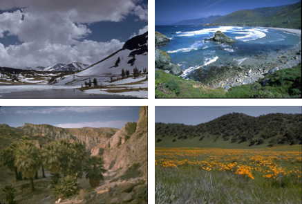
Click on a bioregion below to find out about the forests, wildlife, climate and landforms found there, along with information about the threats facing each area.
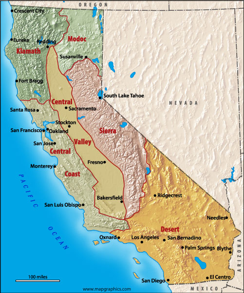
- Klamath Bioregion
- Modoc Bioregion
- Central Coast Bioregion
- Central Valley Bioregion
- Sierra Bioregion
- Desert Bioregion
©2026 Forests Forever. All Rights Reserved.